The Alaska-Yukon Region of the Circumboreal Vegetation Map
The circumboreal vegetation mapping (CBVM) project is an international collaboration among vegetation scientists to create a new vegetation map of the boreal region at a 1:7.5 million scale with a common legend and mapping protocol. The map is intended to portray potential natural vegetation, or the vegetation that would exist in the absence of human or natural disturbance, rather than existing vegetation that is commonly generated at larger scales. As a contribution to the CBVM effort, Torre Jorgenson, Alaska Ecoscience, and Del Meidinger, Meidinger Ecological Consultants Ltd., developed maps of bioclimatic zones, geographic sectors with similar floristic variability, and vegetation in boreal Alaska, Yukon, northwestern British Columbia, and a mountainous portion of southwest Northwest Territories—termed the Alaska-Yukon region. The work was supported by the U.S. Fish and Wildlife Service, Yukon Parks, the Northwest Boreal Landscape Conservation Cooperative, and the Conservation of Arctic Flora and Fauna working group of the Arctic Council.
The effort included maps of bioclimates with 12 bioclimate zones, biogeographic provinces delineating the Alaska-Yukon and Aleutian provinces, and a map of geographic sectors with six sectors that provided the basis for classification of boreal vegetation. Mapping used MODIS imagery as the basis for manual image interpretation and an integrated-terrain-unit approach, which included classifications for bioclimate, physiography, generalized geology, permafrost, disturbance, growth from, geographic sector, and vegetation. A new tree line was developed for the region. Vegetation was mapped at two hierarchical levels, including: (1) 13 formation groups differentiating zonal and azonal systems; and (2) 21 geographic variants based on bioclimatic zonation and dominant species that characterize broad longitudinal regions or biogeographic provinces. Each of the geographic variants was described by identifying the dominant and characteristic species and its climatic and landscape characteristics, as well as references that relate to the unit.

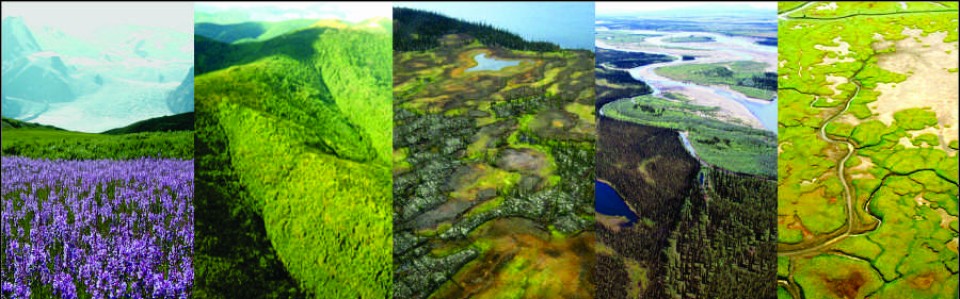
Views of main zonal forest types of the Alaska-Yukon region.

Map of boreal vegetation (level 2) in the Alaska-Yukon region.
The report and maps are available at:
Jorgenson, M. T. and D. Meidinger. 2015. The Alaska-Yukon Region of the Circumboreal Vegetation Map. Conservation of Arctic Flora and Fauna,, Akureyri, Iceland. CAFF Strategies Series Report. ISBN: 978-9935-431-48-6, 39 p.


